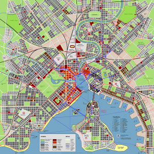
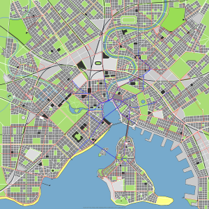
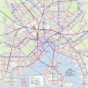
An urban geofiction project by Horst Buchholz (Bienenbüttel, Germany).
Aaby was planned in a concentrated and compact way. The structure—apart from the old town—is based upon a rectangular street grid that is broken in some points to give orientations to the citizens. There is a well‑developed shopping district (Esplanade) as well as a market district (Bazaar) in the downtown area and the cultural university district south‑west of the inner city. In the south‑east, a small-trade and artisan district has been developed along the harborfront. Metros (elevated outside the inner city), trams, funicular railways, suburban railways and ferries form a dense public transit network. There are no motorways. A city with short distances. Jane Jacobs would be satisfied.


I would like to have a simple goefiction map, preferably of a mixed urban/rural area, to help to set up a teaching activity. Is there a copyright free map I can use for this purpose.
Thanks
Hi Paul, nice idea! I tried to find maps that hopefully suit your plans: What do you think about Wittersberg? A small city with rural surroundings. Or maybe As-Perdenoy? Forberg could also work for you, but here the focus is on the urban part (it’s quite a big city). Here’s another one, but the scale is smaller, so less details – but maybe interesting for you: Konthuan. Orlent is also one that I can recommend. Does one of these cities/maps fulfill your needs? Or another one from the Urban Geofiction collection? Then please let me know which one you want to use. You can use the maps for your purpose, but please tell me which maps you want do use, so that I can give you the details. Thanks.
Thanks for that reply – I really do appreciate it. The one that seemed most useful for my purposes was https://urbangeofiction.stadtkreation.de/wp-content/uploads/2012/11/roantra_towns_02.jpg
Ideally I would like it without the town names, because what I want to do is to overlay some very simple titles on the landscape (eg “Gold Mines; Hostile Tribes; Fishing” etc). The task is to discuss what it takes to develop an effective strategy, and the analogy is developing a navigation plan.
However, even as it stands the map will be fine for that purpose, provided that the author is OK with me using it. I am happy to provide details of its use in context if that is of interest or value to the author. Thanks
Hi Paul,
the author of the map is Thilo Stapff. I talked to him about your issue. If you have further questions about it, just ask him. His e-mail address is: [see the e-mail I sent to you, it contains his e-mail address and attached versions of the map]
He is able to include many different layers (e.g. railway lines, roads, municipal boundaries) to the map. So feel free to ask him, if he can provide the map with other layers included.
The license for the map (as for generally all other maps on Urban Geofiction) is: CC BY-NC-SA
http://creativecommons.org/licenses/by-nc-sa/3.0/
I just had another request for using a map for teaching purpose. So my comment here includes all the details you need to know:
https://urbangeofiction.stadtkreation.de/about/#comment-793
I hope, this explains everything you need, otherwise just let me know.
Thilo, like me, is very interested in feedback how you used the map, what were the reactions to it and so on. So we’re looking forward to hearing from you about it.
Best regards
Johannes