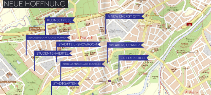
Fictional maps can be a useful playground or setting for workshops or teaching purposes in planning and education: Using an “empty” topographical map and let the people figure out where settlements are most likely to evolve, let the students figure out the most probable history of a given region or what type of economic strengths and weaknesses might exist there. Or, like in the workshop that was conducted by members of the “Nexthamburg” team in March 2013: Use an urban neighbourhood or distrcict of an imaginary city to project common social, ecological, economical, architectural and other problems known from real places to a fictional scene and setting and let the people consider versatile solutions for a “better future”. For the “Planning workshop Neu Dorlach 2025”, a district of Forberg was used. You can find details about this workshop at Nexthamburg’s “Neu Dorlach” project page. And have a look at the workshop report. There are many other possible contexts for using fictional maps in planning and education.
Urban Variations added
Search
Info
-
Recent Posts
Archives
- September 2018
- June 2018
- May 2018
- March 2018
- February 2018
- January 2017
- December 2016
- April 2016
- February 2016
- January 2016
- December 2015
- May 2015
- October 2014
- August 2014
- June 2014
- December 2013
- October 2013
- September 2013
- August 2013
- June 2013
- May 2013
- April 2013
- March 2013
- February 2013
- January 2013
- November 2012
- April 2012
- March 2012
Categories

